
We only had a week in Iceland and were keen to hike to explore the landscape. The Laugavegur trail is one of the most popular in Iceland due to its close proximity to Reykjavik, its easy access by bus and good huts along the way.
Most guidebooks will recommend around 4 days for the route despite it only being 54km. We had limited time and hoped to do the continuation route of the Fimmvörðuháls and end up in Skógar to the coast so planned to do the Laugavegur trail in 3 days.
There’s a lot of blogs out there on the trail due to its popularity but the one website you really want to check out is the one operated by the Icelandic huts – here you can find out about the trail, river crossings, and hut bookings.
As this is a very popular trail don’t expect to be able to get into the huts to stay, we had to carry a tent for the hike as we couldn’t get booked into the huts despite calling months in advance. And this was at a time of covid travel restrictions.

Day 1: Landmannalaugar to Hrafntinnusker (12km – 470m ascent)
Having caught the bus from Reykjavik at 6.30am we arrived at the start of the trail at 11am. The bus ride itself was pretty epic as it turned off the tarmac roads on to the dusty trails which wind across the volcanic landscape.
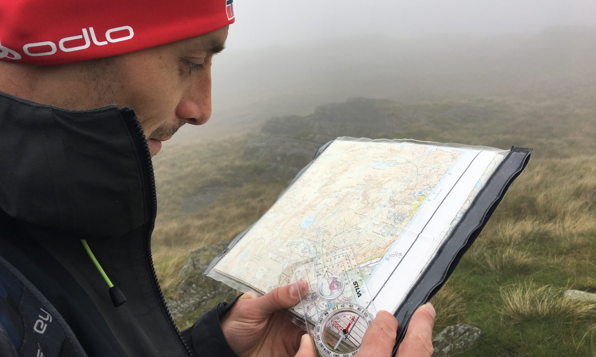
The trail is very well way marked, but its still worth having a map, particularly on the first day as the trail heads uphill onto the volcanic plateaus. If the cloud rolled it this would be fairly featureless terrain to navigate across.


We crossed Rhyolite hills and obsidian rubble, steaming rivers and old snow banks. The views from the top of the hill to the glacier topped mountains were amazing.
The first thing that struck me was for such a barren landscape it is pretty colourful – reds, sands, black, bright neon green mosses and grey lichens. There’s no vegetation though.


We arrived at the Hrafntinnusker hut about 2.30pm. We could have continued on to the next hut but as the weather was good we stopped and made the most of being here at the highest point on the trail.


Day 2: Hrafntinnusker hut to Emstrur (28km – 530m descent)
It was amazing to wake in the volcanic mountains and see the amazing sunrise. (Although by the time we’d packed the tent up the fog had rolled in).

From here the route heads south and while it is generally downhill there is a lot of undulating terrain to cross. Leaving the hut we were crossing complex terrain of mini river valleys, geysers and endless up and downs. I’ll be honest, without the stakes guiding the way this could be mentally challenging to navigate through.

Thankfully across the whole plateau the trail is marked about every 20m with stakes – making way finding much easier.


After a while we headed up a steep hill onto a ridge, beyond the steaming vents, to start to descend steadily downhill. This marks a massive change in the landscape. Here it opens up to a lush green valley.


Eventually we reached the river which had to wade across. There’s a rope to hold, but it still involved getting wet and disappointingly it wasn’t geothermal warm but ice cold!
From here it was an easy 5km to the Altavatn hut by the lake. We arrived here at lunchtime so ate our packed lunch and had a coffee at the hut cafe. We then carried on, with another 16km ahead of us.


We’d been doing a fast pace and the route was much flatter from here.

Altavatn to Emstrur does involve a couple of river crossings, with the first one being fairly easy. As we continued around the hill the landscape changed again to a bleak ashy wasteland, and it then started to feel like a slog through a featureless terrain.


We crossed two rivers on bridges, but in between these one river we had to wade across – it was deep, cold and fairly fast. Once in, I faced upstream and got on with it. I should add walking poles are fairly essential for this trek if only for the rivers crossings.

The last 5km to Emstrur felt like it went on and on, not helped by the ashy desert. We arrived at 6pm to a very busy hut. So busy we struggled to find somewhere to pitch the tent.


It felt like a beast of a walk carrying our heavy camping kit so we were glad to shower, eat and sleep.
Day 3: Emstrur to Porsmork (15km – 300m descent)
The final section of the hike felt like a day up Snowdon in summer. There had been so many commercial groups camping at Emstrur that the trail felt insanely busy.
The weather had also changed to damp and foggy so not long after crossing the epic gorge we were in the cloud for hours. We could have been on the Peak District moors at home as the landscape was fairly similar and we couldn’t see much beyond us.
Along this section the gorge is the only real feature of note, at least from what we could see in the fog! It’s also the only time I bothered to get my camera out!


There was one more river to cross which wasn’t deep but was fast and wide and the quantity of people at this point made a difference to progress.
From here the route headed down into the woodlands to the end of the trail.


We’d heard about the weather forecast changing in advance of us leaving the Hrafntinnusker hut which played a part in us doing two days together in the middle. It also meant we knew we wouldn’t be able to do the continuation trail to Skogar due to the high winds forecast.
Whilst it wasn’t the most enjoyable way to see the trail, it did mean that we were able to get a bus back to Reykjavik a day earlier. Had we stuck to our original 4 day hike plan we would have found ourselves stranded in Porsmork as the buses were cancelled for that day due to the weather and predicted rising river levels.
I was surprised when we found this out but to leave Porsmork the buses ford the river to get out of town, so it does mean any plans to hike the trail need to be fairly dynamic to changing weather.

If you have limited time in Iceland then this is a fabulous trek to complete as it gives you chance to see the changing landscape across the volcanic terrain.