
I’d hoped that Christmas would have marked the start of the winter and provide me with the start of winter log book days for this season, ahead of me preparing for my Winter Mountain Leader Assessment in a few months.
Whilst there had been snow in December, by the time we arrived in Fort William we were in the middle of a thaw and the North Face of Ben Nevis was devoid of snow – except on the very upper reaches of the gullies.

Despite this we set off at 7.45am in the dark to do the Carn Mor Dearg arête and Ben Nevis, a challenge even in December’s ‘summer’ conditions.
CMD Arete
The walk through the woodland from the North Face car park is straightforward even in the dark and takes about an hour to get to the fence which marks the open moorland and access to the North Face of Ben Nevis.
It was a typical Scottish morning and the dark was accompanied by wind and rain. We soon found the barely noticeable footpath off the main track which heads up onto Carn Beag Dearg and beyond to the wide open ridge to the munro summit of Carn Mor Dearg.
It was noticeable how mild the conditions were as we immediately started wading through moorland bog as we trudged uphill.

Despite heading into the mist around 600m the route isn’t complicated as it heads south-east along the top. A cairn marks the first summit of Carn Dearg Meadhonach before reaching the summit of Carn Mor Dearg.
We had been here in March in the midst of the fantastic winter but were beaten back by strong winds; it was such a contrast to be here in mild damp conditions.
Beyond the summit, the CMD arête begins to head south before curving round the head of the valley south westwards, towards the col before Ben Nevis. At around 1.5km long it is certainly a committing ridge as you cannot escape once on it, without retreating.

Despite being a grade 1 scramble in summer conditions, it is not as complicated as Crib Goch or the Devil’s Ridge on the Ring of Steall, as there are no technical scramble sections which cannot be completely avoided. That said in winter conditions it would be a committing and slow undertaking.

Ben Nevis
From the col the route scrambles up between the rocks to reach the summit of Ben Nevis. Whilst the summit did still have snow, it wasn’t so significant that we had to use crampons or axes. The mist wasn’t even so low that we couldn’t see the large summit cairns marking the way.


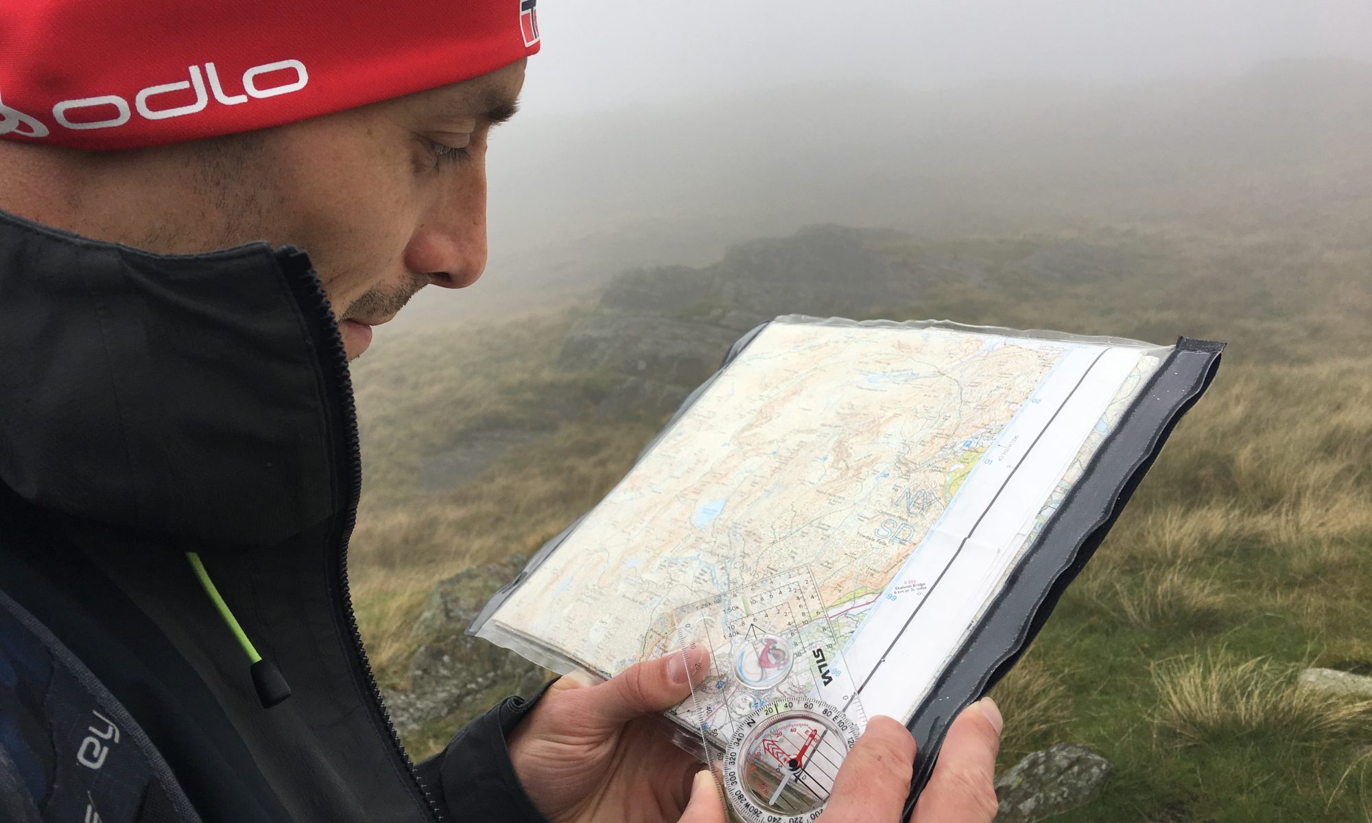
That said its important to be prepared up here, as the summit plateau is treacherous in poor visibility. Gardyloo Gully is very close to the trig point, and requires navigation around to get back to the tourist path back to Glen Nevis.
Its useful to have the key information scribbled on the edge of your map to aid descent – a bearing of 231 degrees walked for 150m, then stay on 282 degrees to reach the zigzag path and the large cairns. Beware that if you stray too far on the first bearing its possible to mistakenly enter the top of Five Finger Gully. Be confident in your pacing in poor visibility.
If you want a detailed article on navigating on the summit check out UKHillwalking.

Despite it being December as we descended we met the ubiquitous idiot in shorts with no map, casually dragging his partner to the summit. I couldn’t help remarking to him that I hope he kept warm in the wind, and while he looked sheepish I doubt he’d make a different decision next time.
The zigzag path back down is easy to navigate once on it, although once at the ‘halfway loch’ (Lochan Meall an t-Suidhe) we headed off on the path northwards to more bog trotting as we headed back to the track to the North Face car park.


