
The next three days of the Tour du Mont Blanc would take us from the pristine Alpine villages of Switzerland, over the Grand Col de Ferret the highest point of the TMB route, and into Italy – from the home of fantastic cheese and chocolate to the home of fantastic gelato and … chocolate.
Day 4 – Champex to La Fouly – 5 hours 50
Total distance 14.6km ascent 555m descent 440m
Today’s walk would take us through some gorgeous quiet villages as we headed for the end of the valley and our last campsite in Switzerland. It was a cooler day and having a relatively flat route it was also more relaxed.
The start of the walk from Champex takes you through the Santier de Champignons – route of the mushrooms; evident by the trees carved on the woodland trails.


When we reached the road at Issert (and stopped for a hot chocolate) it had begun raining, making the walk through the villages to Praz de Fort less interesting. If your following the cicerone guide on the clockwise route this would be your first days walk, which is described as “a charming pastoral valley whose timber chalets and haybarns recall a long-lost era…” I’m afraid for us it was waterproofs on, head down.


Once we reached Praz de Fort we followed the route along the river to our campsite at La Fouly. Initially a nice track it become a slow gradual ascent, and as a track it wasn’t a particularly lovely route to follow, it became a slog. So it was a surprise to find a huge campsite at La Fouly.


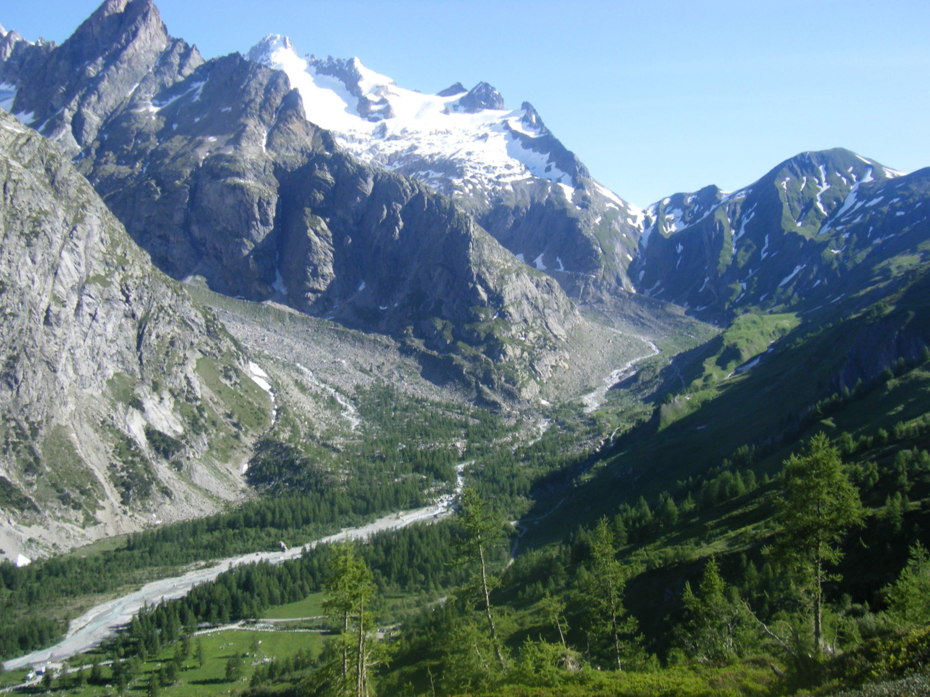
Day 5 – La Fouly to Planpincieux 8 hours 10
Total distance 21km ascent 930m descent 940m
Like gluttons for punishment we started the day by veering off the main TMB route to take the steeper variant route, which would allow us to climber quicker up the pass and also have a more scenic view through the spring alpine meadows. Nevertheless it was a grateful surprise to find the refuge at La Peule.


After drinks at La Peule we continued on upwards to the Grand Col de Ferret, where the top of the pass was still covered in snow, making the walking slower. The view down into the Val Ferret and Italy was worth the effort though.


At 2537m the Grand Col de Ferret marks the high point on the TMB. After admiring the massive view of the valley below, it occurred to us that our campsite at Planpincieux was down there somewhere and we still had a long way to go. The route down the valley was long and steep initially so it was good to know a hot chocolate stop at Refugio Elena was half way down, although we could see the refuge long before we got there. The hot chocolate was like mud and worth it.
From the refugio it was another two hour walk down the track where, passing the refuge Val Ferret we left the TMB main route and followed a path down to the road to the campsite at Planpincieux which, on tarmac, was hard on the feet.


Day 6 – Planpincieux to Courmayeur 5 hours 20
Total distance 13km, ascent 625m descent 865m
Having complained the day before about walking down the road and the fact the summer bus service started that morning, we decided it would be stupid to do the road section again, just to reach the TMB path. So we caught the bus up the valley to the route.
From La Vechy we ascended up a path to pick up the TMB at the Refugio Bonatti – where I can confirm the best hot chocolate in the world is served. Like thick mud. Mmmm


From the refugio Bonatti we headed onwards towards the refugio Bertone; as there was still a lot of snow melting on the high ridge, the rivers we crossed en route were still in spate and required good balance and acceptance that feet were going to get wet.


From Refugio Bertone we headed downhill in to Courmayeur town centre. This section was very busy with families headed upwards. Thankfully we had quite a wait for the bus back up to our camp at Planpincieux so we had time for gelato and a trip up the cable car to admire Mont Blanc up close.


